
Satellite images and open-source data help you get real-time, accurate updates during breaking news events. They give you a bird’s-eye view to verify reports, spot unseen details, and confirm events quickly. Crowdsourced content from social media can be cross-checked with satellite data for authenticity, reducing misinformation. Combining these tools strengthens the credibility of reports and keeps you informed with trustworthy information. If you want to discover how these sources enhance coverage, keep exploring what they can do.
Key Takeaways
- Satellite images provide real-time, accurate visual confirmation of events during breaking news situations.
- Open-source data and social media reports enable rapid cross-referencing and verification of information.
- Geospatial intelligence helps analyze spatial relationships and track movements for better situational awareness.
- Combining satellite and open-source data enhances credibility and reduces misinformation in news reporting.
- Real-time data integration allows quick adaptation and informed decision-making during fast-evolving events.

Satellite Images and Open-Source data have become essential tools for breaking news coverage. When a major event unfolds—be it a natural disaster, conflict, or sudden political development—you need real-time, accurate information. Satellite imagery provides a bird’s-eye view that can confirm reports, reveal unseen details, and help you act swiftly. Combined with open-source data, like social media posts and citizen reports, these tools give you an extensive picture of unfolding events. This integration allows you to verify information rapidly, reducing the spread of misinformation and ensuring your coverage remains credible.
Crowdsourcing verification plays a vital role here. When eyewitnesses or local sources share images and videos online, you can cross-reference these with satellite data to authenticate claims. For example, if social media reports a bridge collapse, satellite images can confirm whether the destruction aligns with those claims. This collaborative approach harnesses the power of the crowd, enabling you to validate information quickly and accurately. It also helps you identify false reports, which are common during breaking news situations, by comparing user-generated content with geospatial intelligence. This process enhances your ability to deliver trustworthy updates in real time. Additionally, understanding the contrast ratio of satellite images can improve the clarity of visual evidence, especially in low-light or dark conditions, further aiding verification efforts. Recognizing the importance of geospatial intelligence can give journalists a strategic advantage in analyzing spatial relationships and tracking relevant movements. Incorporating real-time data analysis further boosts your capacity to respond swiftly and precisely to rapidly evolving situations. Moreover, leveraging open-source data from diverse sources increases the depth and reliability of your reporting in fast-changing scenarios.

Artificial Intelligence Techniques for Satellite Image Analysis (Remote Sensing and Digital Image Processing, 24)
As an affiliate, we earn on qualifying purchases.
As an affiliate, we earn on qualifying purchases.
Frequently Asked Questions
How Do Satellite Images Differ From Aerial Photography?
Satellite images differ from aerial photography mainly in their altitude and coverage. You get high-resolution imagery from satellites orbiting far above the Earth, providing a broad perspective. Aerial photography is captured closer to the ground, often with planes or drones, offering more detailed images. Using advanced image analysis techniques, satellites can monitor large areas quickly, while aerial photos are ideal for detailed inspections of specific locations.
What Are the Limitations of Open-Source Information During Emergencies?
During emergencies, open-source information has limitations like public bias and data accuracy issues. You might rely on social media or reports that are influenced by personal opinions or misinformation, making it hard to verify facts. These factors can distort the true situation, so you should cross-check open-source data with verified sources. Always consider potential biases and inaccuracies to guarantee a clear, accurate understanding of the emergency circumstances.
How Quickly Can Satellite Data Be Processed for Breaking News?
Satellite data can be processed for breaking news in a flash, often within minutes to a few hours, like lightning illuminating the sky. Real-time analysis is vital here, allowing you to access timely images that reveal unfolding events. While data accuracy depends on the satellite’s resolution and processing speed, advancements continue to shorten the time lag, helping you stay ahead of the story with the most current, reliable visuals available.
Are Satellite Images Publicly Accessible or Restricted?
Satellite images are generally restricted due to government regulations and privacy concerns. While some open-source images are accessible to the public, high-resolution or sensitive images often require special permissions. You need to be aware that accessing certain satellite data might involve legal limitations, especially if it risks privacy or national security. Always check the source and legal guidelines before using satellite images for any purpose.
How Do Journalists Verify the Authenticity of Open-Source Data?
You verify open-source data’s authenticity through crowdsourcing verification, where multiple sources or experts confirm details, ensuring accuracy. You also cross-check data with trusted sources like official reports or satellite images. Look for consistency, metadata, or timestamps to confirm data authenticity. By combining these methods, you reduce the risk of spreading misinformation, making your reporting more reliable and credible during breaking news coverage.

Garmin dezl OTR610, Large, Easy-to-Read 6" GPS Truck Navigator, Custom Truck Routing, High-Resolution Birdseye Satellite Imagery
6” touchscreen truck navigator offers a bright, crisp high-resolution display
As an affiliate, we earn on qualifying purchases.
As an affiliate, we earn on qualifying purchases.
Conclusion
As you harness satellite images and open sources, you unlock a powerful lens into the world’s most urgent moments. These tools become your compass, guiding you through chaos with clarity and precision. In a landscape where information is fleeting, they stand as unwavering beacons, illuminating truths hidden in the shadows. Embrace this synergy, for in the dance of technology and truth, you hold the key to understanding what truly matters—making every breaking story a story worth telling.

Python for Geospatial Data Analysis: Theory, Tools, and Practice for Location Intelligence
As an affiliate, we earn on qualifying purchases.
As an affiliate, we earn on qualifying purchases.
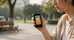
crowdsourced verification app
As an affiliate, we earn on qualifying purchases.
As an affiliate, we earn on qualifying purchases.